The wall
Lofoten gets the crowds; Helgeland gets the same coast without them. Everything I've learned driving the Kystriksveien and hopping its islands: when to go, how long to stay, how the ferries work, and the hikes, beaches and outposts actually worth your time.
Helgeland is the southern stretch of Nordland, the part of the coast between Trøndelag and the Arctic Circle. Its spine is the Kystriksveien – the Fv17 coastal route, about 625 km from Namsos to Bodø with six ferry crossings – and off it sits a wide belt of islands, white-sand beaches, and the distinctive coastal mountains that gave the region its legends: Torghatten with the hole through it, the Seven Sisters, the recumbent lion of Rødøyløva. Inland, the Svartisen glacier reaches almost to the sea.
The pitch is simple: it looks a lot like Lofoten, often quieter, and you have to work a little harder to reach it. Ferries and express boats set the rhythm, so you plan around timetables rather than just a single road. That friction is the whole point – fewer tour buses, more islands where the permanent population is in single or double digits. This guide is how I'd plan it: the timing, the drive, the island hops, and the stops I send friends to.
5–7 days drives a good stretch of the Kystriksveien with a couple of island hops and one big hike, and absorbs a weather day. A week or more does the full Namsos–Bodø route with detours. 3–4 days works if you pick one section – say Brønnøysund, Torghatten and a single island.
Brønnøysund (south): the gateway to Torghatten and the Vega islands. Sandnessjøen (central): under the Seven Sisters, the best hub for Dønna and the central islands. Lovund or Nesna: jumping-off points for the outer islands. Most people move as they drive rather than fixing one base.
A car on the Kystriksveien is the backbone – the Fv17 runs ~625 km with six ferry crossings, so build the timetables into your day. Express boats and ferries reach the islands; some have no car access at all. Fly into Brønnøysund, Sandnessjøen or Mo i Rana, or arrive by the Nordland train to Mo i Rana or Bodø.
Ferries set the pace here, so plan loosely and check timetables at Reis Nordland before committing to an island. For a special night, Camp Vega sits in the UNESCO archipelago. Norway's right-to-roam lets you wild-camp responsibly away from homes – and most islands have a simple campsite or guest harbour.
The stops below, pinned along the Helgeland coast from Torghatten in the south to Svartisen and the northern islands. Drag to explore.
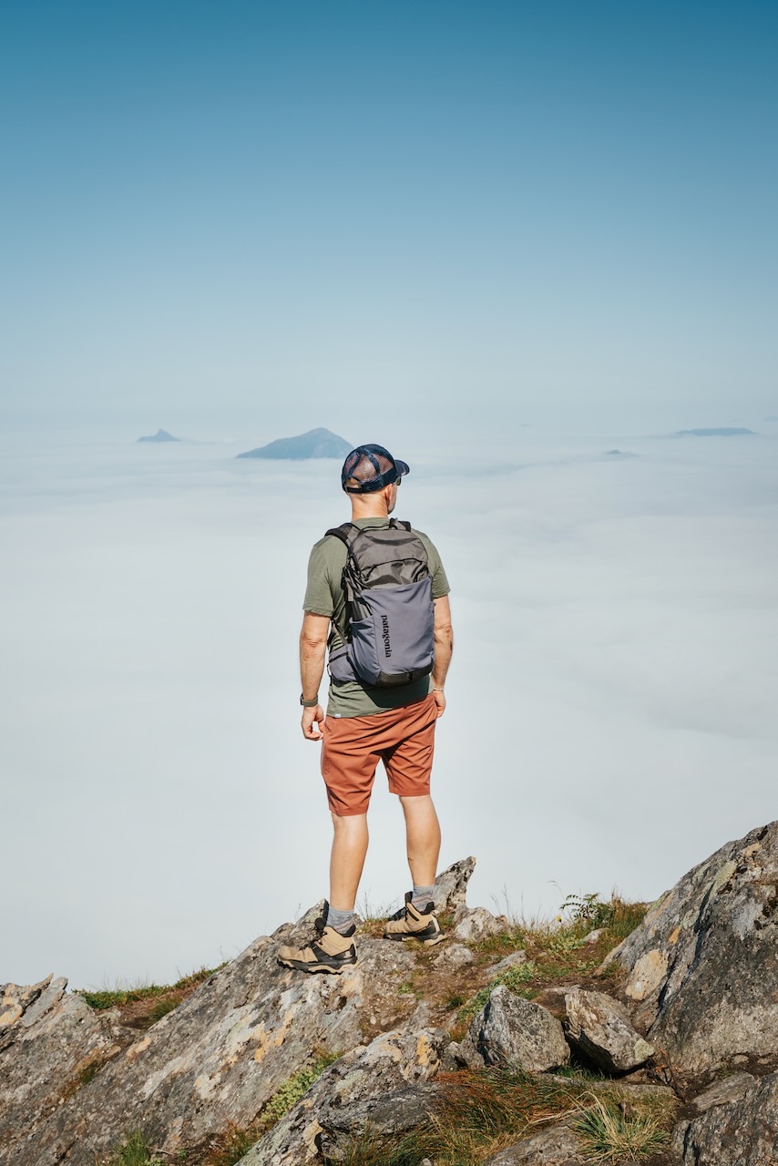
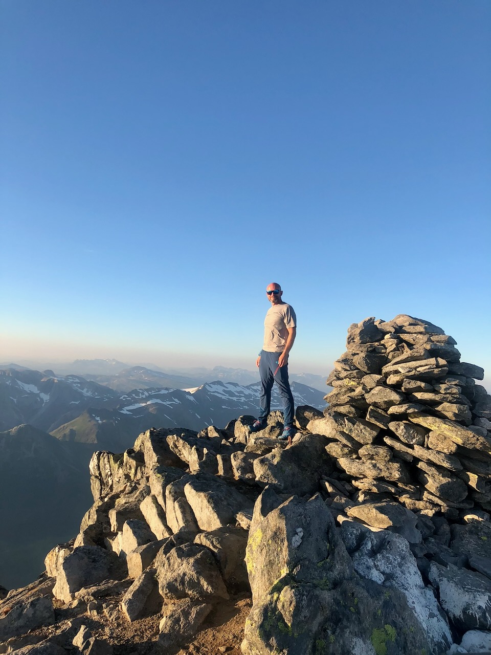
Helgeland's peaks rise straight out of the sea, so you gain real height fast and the views run from glacier to open ocean. These are the ones I'd prioritise, easiest to hardest. Always check the latest figures and ferry times before you go – several of these start with a boat.
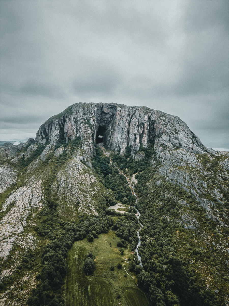
The symbol of Helgeland: a granite dome on Torget island near Brønnøysund with a 160 m-long tunnel bored clean through its middle by the sea. Walking into the hole, with daylight at both ends, really does reset your sense of scale. A well-built National Scenic Hike from the Torget car park, gentle enough for all ages, and the view back through the arch is the photo.
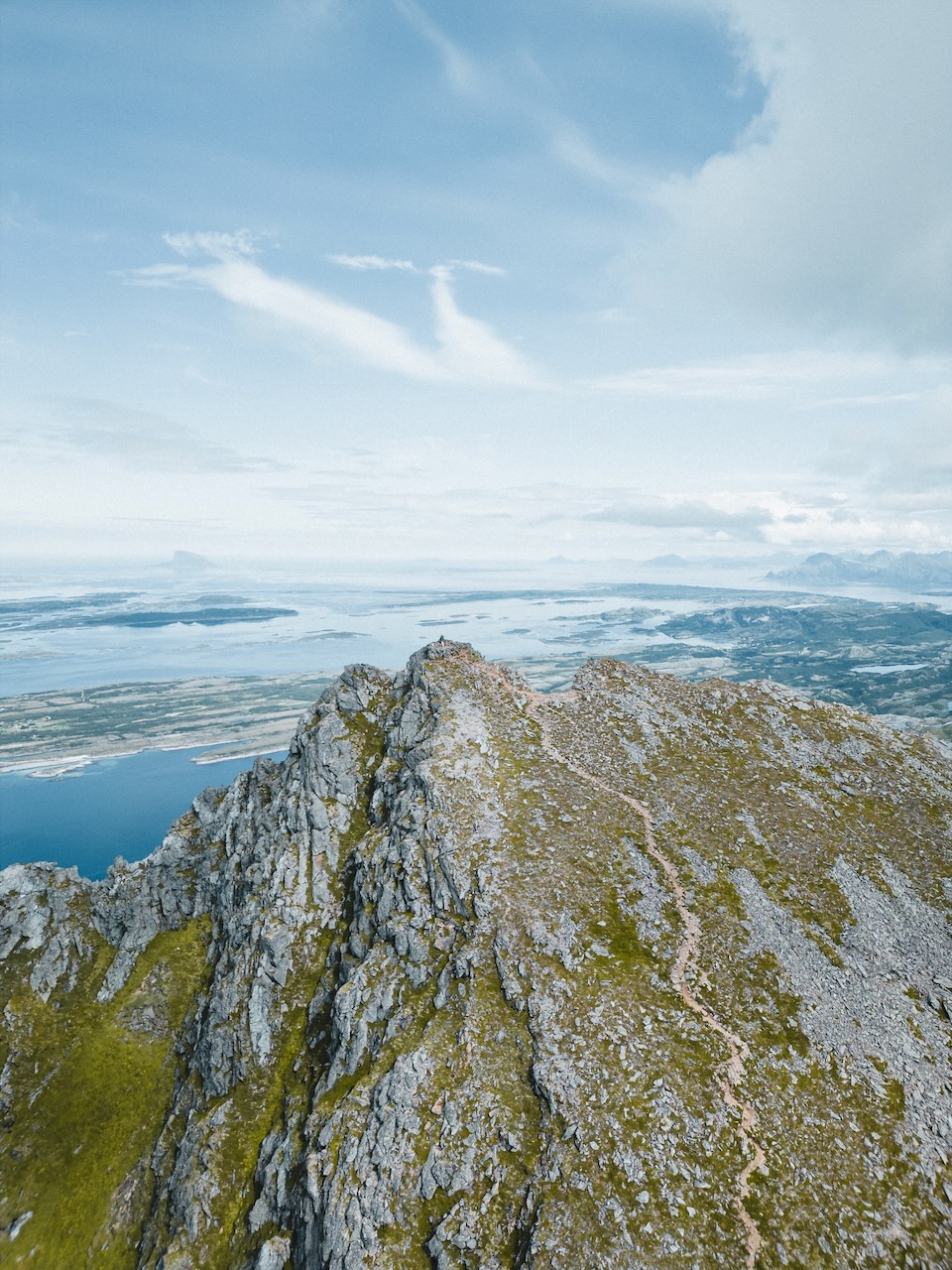
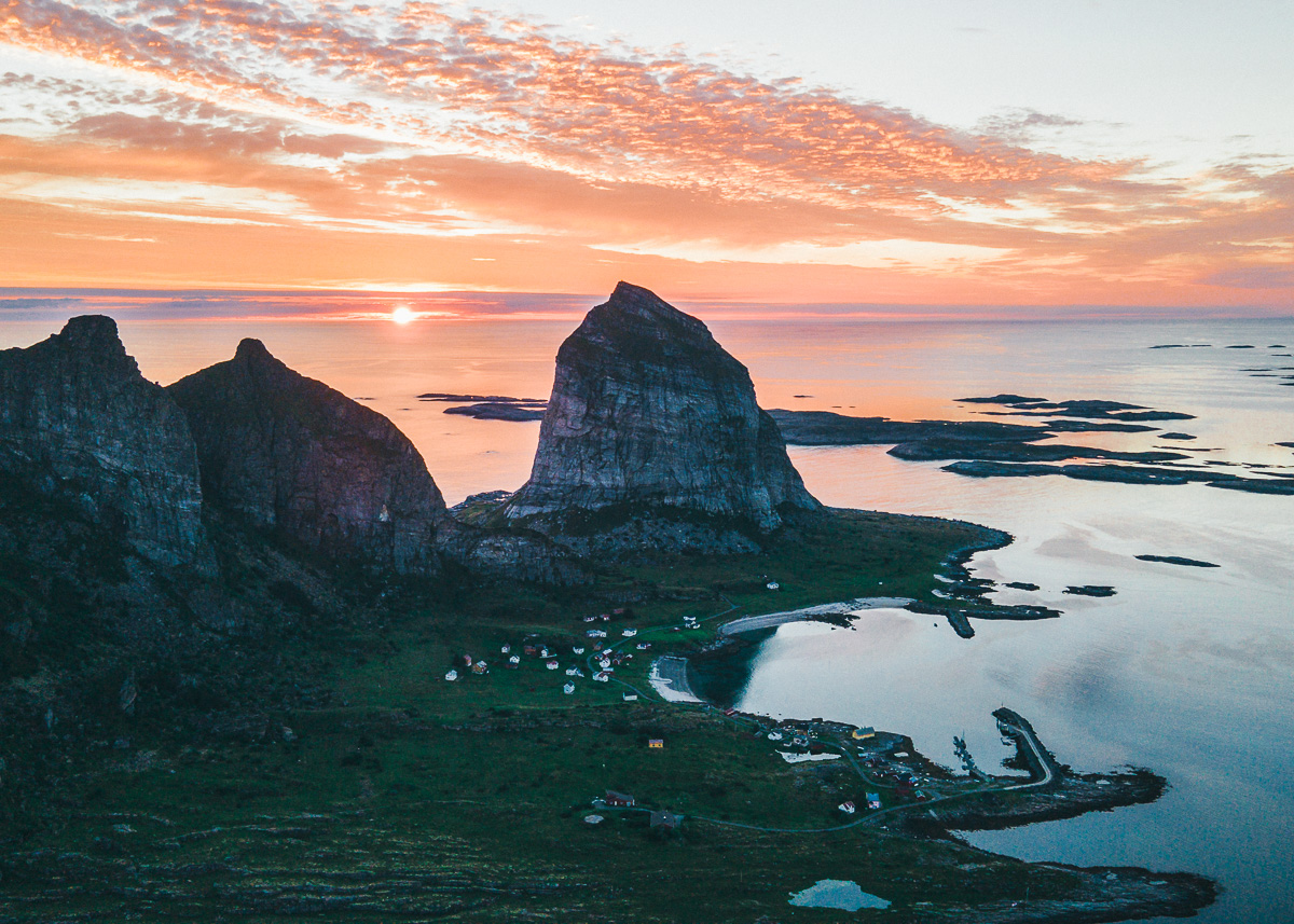
The lion of the coast – a 443 m peak shaped like a reclining lion, rising straight off the island of Rødøya with white beaches at its foot. Most of the climb is on built Sherpa steps; steep but not technical, with a sheer drop at the exposed summit so keep back from the edge. The view runs from the Lofoten wall in the north to Vega in the south. Reach the island by ferry or express boat.
The high point of the island of Tomma, climbing almost from sea level to 922 m for a clean 360° over the central Helgeland islands, with the white beaches of Tomma below. A serious, sustained ascent rather than a quick win – good legs and a settled day. Reach Tomma by ferry from Nesna.
De syv søstre – seven peaks lined up behind Sandnessjøen. Skjæringen, climbed from Markvoll, is the friendliest of them and the one I'd send a first-timer to: a well-marked trail with steep rock higher up, and the option to bag the neighbouring Tvillingene on the same day. Cool off in the Markvollkulpen pools on the way down.
The "Dønna man" lying on his back off Sandnessjøen – three peaks (the nose, lip and chin) with the lip topping out at 858 m. Short but genuinely steep, with hands-on scrambling near the top and exposure close to the edge; locals rate it as tough as the Seven Sisters. Reach Dønna by ferry from Sandnessjøen, then start from Breivika or Einvika. Clear, dry days only.
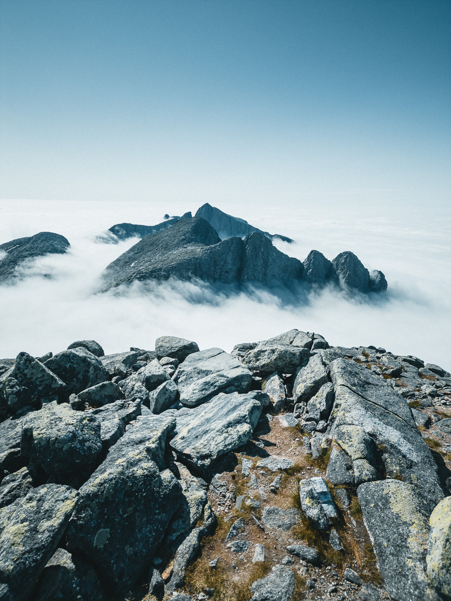
The big one. A shuttle boat crosses Holandsfjord from Holandsvika (~200 NOK return), then a gravel track along Engabrevatnet leads to the steep climb up to Tåkeheimen – at 1 073 m, North Norway's second-highest DNT hut, and a superb place to sleep. From there it's a steep, partly trackless push to the 1 454 m summit of Helgelandsbukken, with the Svartisen ice plateau filling the view. Map, compass and a clear forecast – the name means "the home of fog."
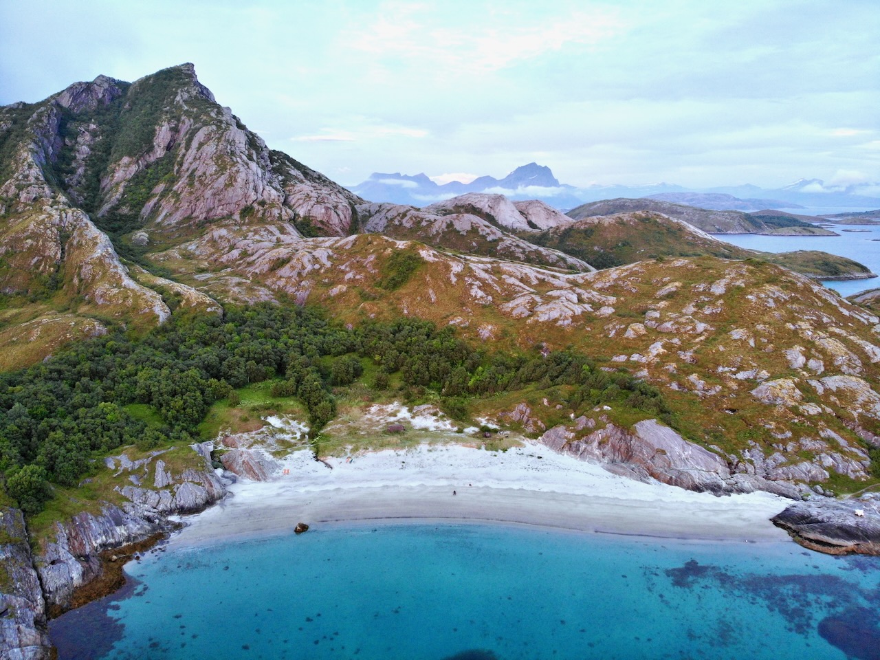
The "Caribbean of the North" tag gets thrown around a lot up here, and on the right island, in the right light, it isn't far off. Cold water, warm sand, empty.
The island under Tomskjelven has some of the finest white-sand beaches on the central coast, backed by the peak and looking out over Sjona fjord. Quiet even in high summer – pair a beach afternoon with the summit climb if you've got the legs, or just stay on the sand.
The white crescent of Storsanden sits right below Rødøyløva, so the obvious play is to climb the lion in the morning and drop down to the beach after. Bright turquoise shallows, the peak at your back, and the kind of stillness that makes you forget how far north you are.
Vega and its 6 500 surrounding islets are a UNESCO World Heritage Site for the centuries-old tradition of farming eiderdown alongside the birds. Low, sandy and laced with quiet shores – more about slow days, the World Heritage Centre and the Vegatrappa stairway than one headline beach. Reach it by ferry; book the night ahead in summer.
Half the pleasure of Helgeland is the outposts – islands with a handful of residents, a lighthouse, sometimes a distillery. A few worth the ferry, and one stop on the drive north.
A green, low-key island with a Renaissance garden at the old manor and the near-700 m Lurøyfjellet rising behind it – one of the great vantage points on the coast, taking in Hestmannen, Rødøyløva, Lovund and the Seven Sisters from a single summit. Reach it by express boat from Stokkvågen or Tonnes.
A wind-scoured cluster of skerries at the very edge of the sea, with about ten year-round residents and, improbably, its own whisky distillery making spirit out here in the salt air. Going to Myken is the whole point of Myken – a long express-boat ride to nowhere much, which is exactly why you'd do it.
Træna is one of Norway's oldest fishing communities, settled since the Stone Age, sitting far out where the coast finally gives way to open ocean. Its largest island, Sanna, is a thin ridge of five jagged peaks – the 338 m Trænstaven the highest – with a population you can count on one hand. Otherworldly, and the home of the Trænafestivalen each July.
Strictly this sits inland near Mo i Rana rather than on the coast proper, but if you're driving north it's well worth the detour – the "Marble Castle," where a glacier-fed river has carved swirling sculptures out of white marble, turquoise water running through it. A short, slightly steep walk in; best in late summer and autumn when levels are lower.
The old Seløy schoolhouse, reopened in 2020 as something rather special: the gym is now a pizzeria and coffee bar, the classrooms are comfortable rooms and apartments, and there's a bookshop and gallery alongside. Family-run, year-round, with the Seven Sisters across the water – and the best pizza on the Helgeland coast, Italian-style on local ingredients. Worth planning a night around.
Three broad options. An island stay like Camp Vega in the UNESCO archipelago, or a hotel in Brønnøysund or Sandnessjøen (practical bases). Camping and guest harbours on most islands, plus Norway's right-to-roam for responsible wild camping. And the DNT huts – Tåkeheimen above Svartisen is one of the finest nights you can have up here. Book island stays and ferries ahead in summer.
A loose, ferry-flexible run up the Kystriksveien if it's your first time. Shuffle days around the forecast and the timetables – save the big hikes for the clear ones.
Fly into Brønnøysund or pick up the route from the south. Ease in with the walk through Torghatten's hole, dinner in town, and a slow evening getting your bearings before the islands start.
Ferry out to Vega for a UNESCO day: the eiderdown story at the World Heritage Centre, the Vegatrappa stairway for the view, and a night at Camp Vega among the islets. Pure slow travel.
Drive north to Sandnessjøen under the Seven Sisters. If the sky's clear, climb Skjæringen from Markvoll and cool off in the Markvollkulpen pools. Keep this as your weather-buffer day – it's worth waiting for.
Ferry over to Dønna for Dønnamannen if you've got the legs and the weather, or take it easier with an island day on Tomma or Lurøy. Beaches, summits, your call.
Hop the express boat to an outpost – Træna, Lovund or the whisky island Myken – or break the drive at Rødøy to climb the lion of Rødøyløva and drop down to Storsanden beach. Ferries set the pace.
The glacier finale: the boat across Holandsfjord toward Engabreen, and the big push to Tåkeheimen and Helgelandsbukken if you're committed – or just take in the ice from the Braset viewpoint. Finish north toward Bodø, or detour inland to Marmorslottet and Mo i Rana.
Helgeland is already quieter than Lofoten, but a few corners reward going further still. Tap the coordinates to open them in Maps, check the boat times before you commit, and leave them exactly as you found them.
Most people see Svartisen from the Braset viewpoint and drive on. Take the shuttle boat across Holandsfjord from Holandsvika instead and walk in along the blue-green Engabrevatnet toward the glacier snout – Europe's lowest-lying glacier arm, reaching almost to the sea. Never step onto the ice without a guide; it moves.
66°40'42" N · 13°43'16" ENorth Norway's second-highest DNT hut, at 1 073 m on the west side of Svartisen, with the glacier arms Litlebreen and Engenbreen for neighbours. A no-service cabin – bring a sleeping bag and food – but waking up to that ice plateau is worth every step of the climb up from the fjord. Don't gamble on the weather; the name means "the home of fog."
66°39'24" N · 13°47'5" EIf you want your shots to look the way these do, my Nordic Lightroom pack is the starting point I use on this kind of cold, high-contrast Arctic light. Six presets, real RAW files behind every preview, 30-day refund. Optional – the guide stands on its own.
More of Norway, same treatment as this one. More on the way.