The wall
Everything I've learned from years of driving the E10: when to go, how long to stay, where to base yourself, and the hikes, beaches and villages actually worth your time. Written for travellers, not just photographers.
Lofoten is an archipelago in Nordland, above the Arctic Circle, where granite peaks drop straight into the sea and white-sand beaches sit below them. It is compact – about 150 km end to end – and almost everything strings off a single road, the E10, so you can base yourself in one or two spots and reach most of the islands on day trips.
It is also busy and expensive in summer, and the weather changes by the hour. None of that is a reason to skip it. It just means you plan loosely, keep a flexible day or two for when the sky clears, and accept that the best light often comes at 23:00. This guide is how I'd plan it for a first or second visit – the timing, the base, the drive, and the stops I send friends to.
4–5 days covers the highlights without rushing. A week is ideal – it absorbs a bad-weather day and fits two or three big hikes. 2–3 days only works if you stay west around Reine and Flakstad and skip the rest.
Reine / Hamnøy (west): the postcard scenery, closest to the best hikes. Leknes (central): practical and central, less charming. Henningsvær / Svolvær (east): more restaurants and life. Many people split: a few nights west, a few east.
Rent a car – or a campervan, which doubles as your bed. Lofoten is built around the E10 and the best stops sit between villages. Buses are slow and sparse. Fly into Leknes, Svolvær, or Evenes; or take the ferry from Bodø to Moskenes.
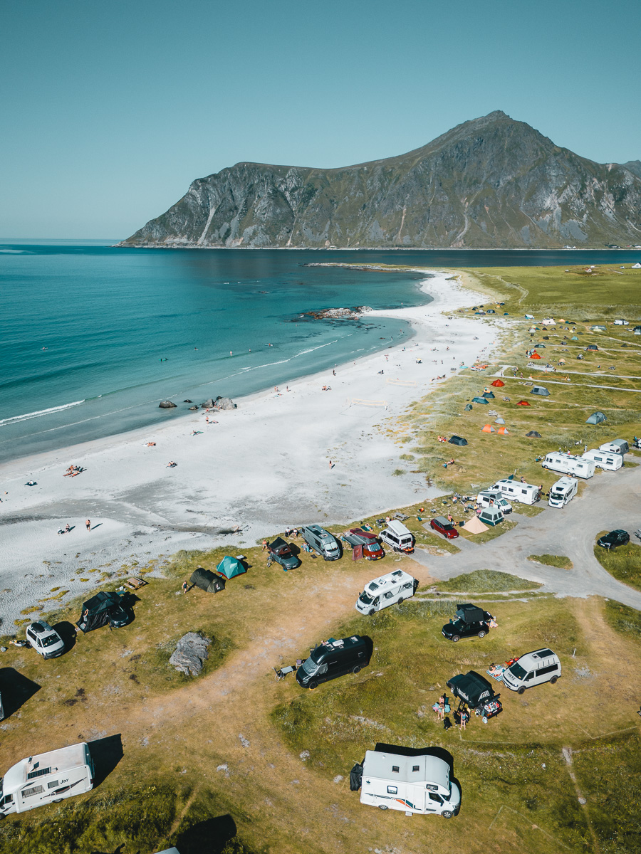
Camping is a way of life here. Campsites like Lofoten Beach Camp put you on the sand, and Norway's right-to-roam lets you wild-camp responsibly away from homes and fences. A campervan is the cheapest, most flexible way to do the islands – wake up where you parked at sunset.
The stops below, pinned along the E10 from the western tip near Reine to Henningsvær and Svolvær in the east. Drag to explore.
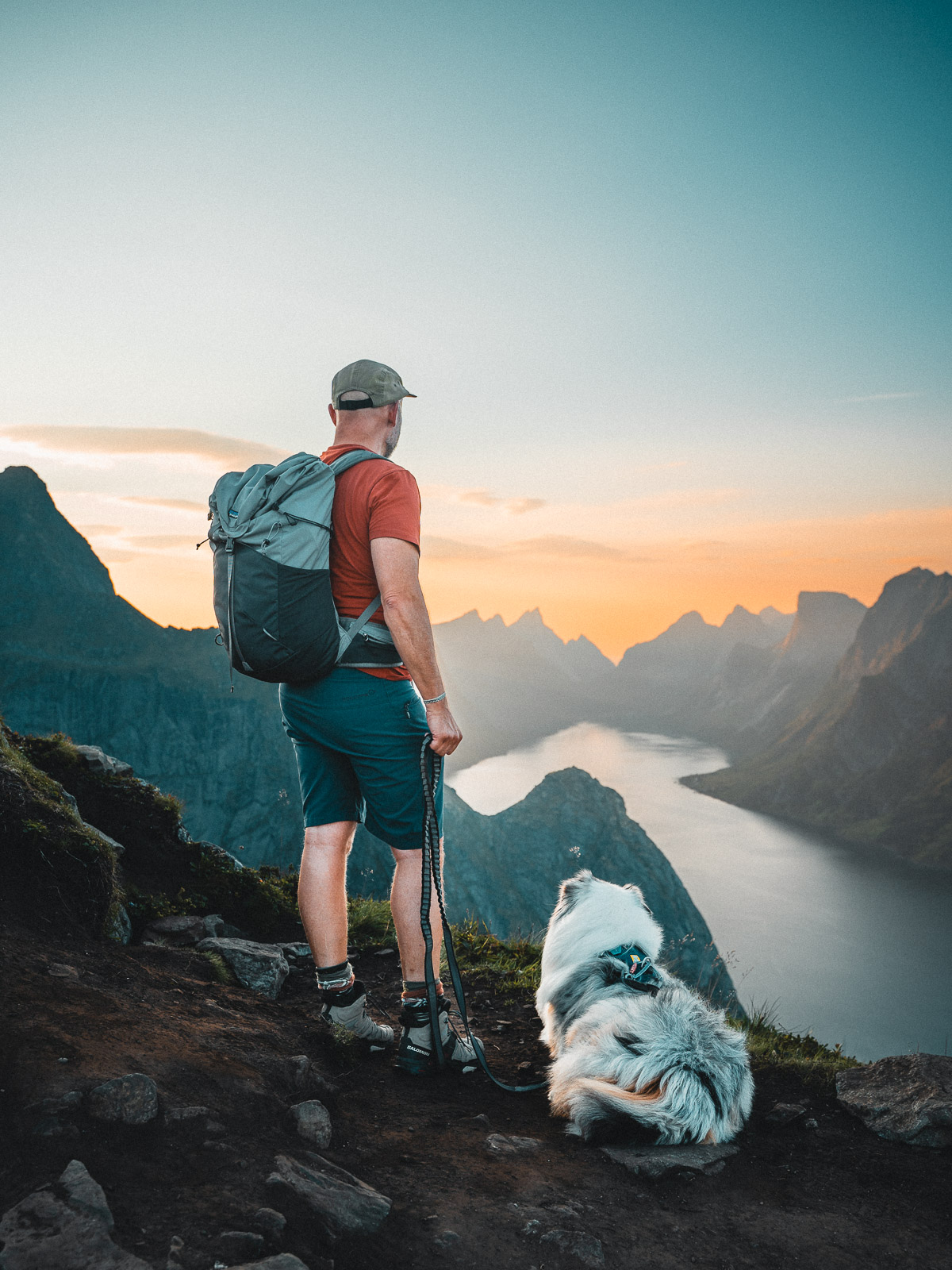
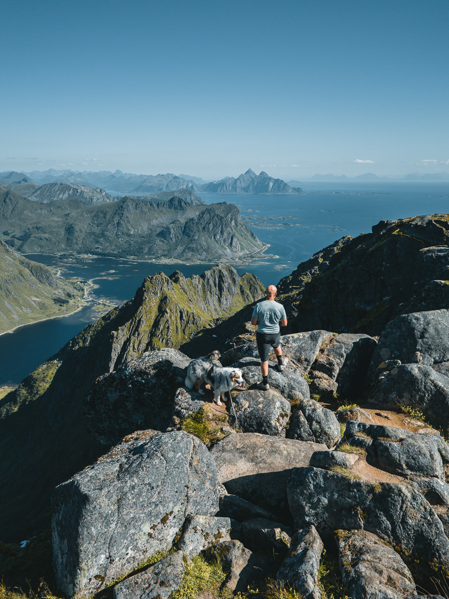
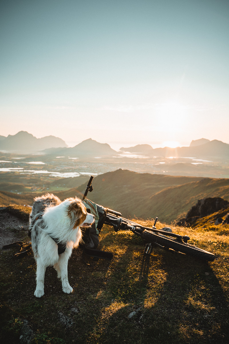
Lofoten rewards anyone willing to walk uphill. These are the ones I'd prioritise, easiest to hardest. Times are one-way for a reasonably fit hiker.
The most photographed view in northern Norway: Reine village curled around the fjord with peaks rising sheer behind it. A built stone staircase does the climbing for you – steep but straightforward. Park early or in Reine and walk back; the small lot fills by late afternoon. Closed in winter due to ice.
A rewarding hike to a flat summit looking straight down on Kvalvika, a wild beach hemmed in by mountains. Combine the summit with a descent to the sand and back. Varied, dramatic, and less of a step-machine than Reinebringen. One of the best days out in Lofoten.
A short climb for an outsized reward: a panorama over the coastline, the bridges and the surrounding peaks. Central, near Leknes, and one of the best effort-to-view ratios on the islands. Good for a half-day or an evening when the light turns.
One of the higher accessible summits in the western islands, with a long ridge walk and a panorama that takes in lakes, peaks and sea on every side. More of a commitment than the quick climbs, and quieter for it. Worth it on a clear, settled day.
A steep haul above Henningsvær for a spectacular view back over the village and its scatter of islets. No built steps here – it's a proper climb with some hands-on sections near the top. Save it for a clear day and good legs.
Lofoten's beaches look tropical and feel anything but. Bring layers, not a swimsuit – though the brave do go in.
A beach you have to earn, reached on foot over a low pass (or down from Ryten). No road, no facilities, often no one else – just sand, surf and mountains. Worth combining with the Ryten hike for the full day.
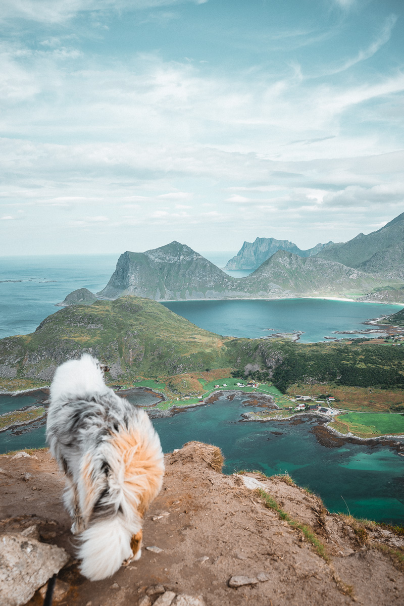
Two of the most beautiful and accessible beaches on the islands, linked by a short coastal path over the headland. Haukland is the classic curve of white sand; Uttakleiv, just over the hill, is rockier and a favourite for the midnight sun and aurora. Paid parking at both.
For travellers with more time, the ferry-and-foot beaches in the far west (such as Bunes, reached from Vinstad) trade convenience for solitude. Check the local ferry timetable carefully before committing – schedules are sparse and seasonal.
The fishing villages are half the reason to come. A few I'd point you to – and a couple of specific places.
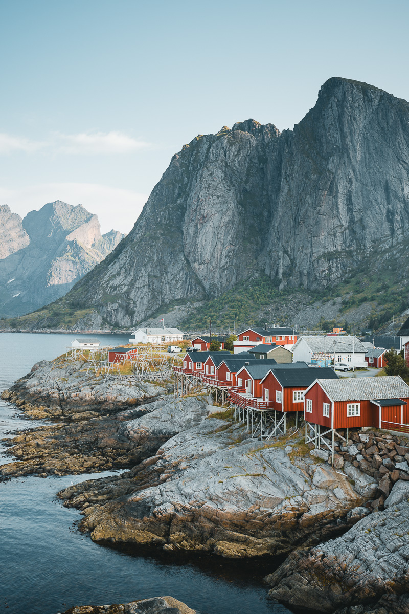
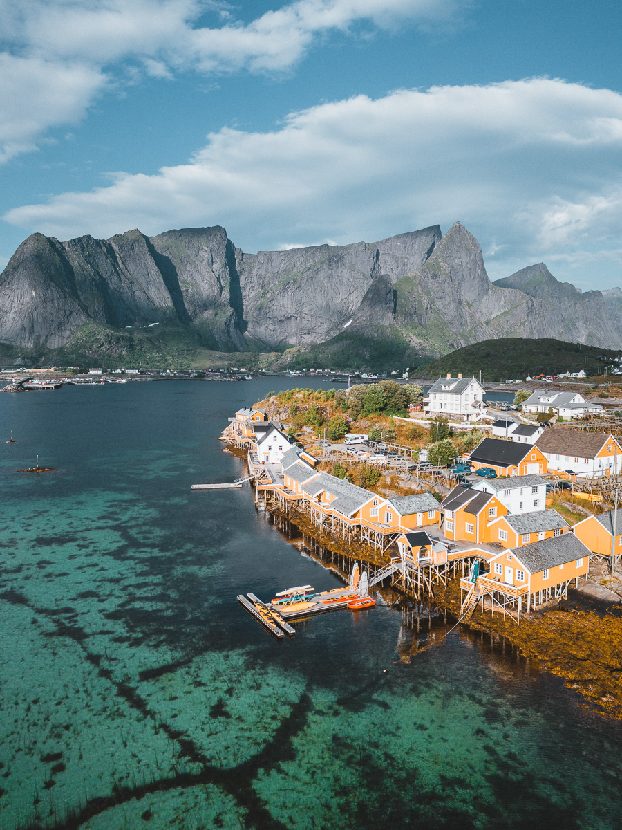
The image most people have of Lofoten: red rorbu cabins on stilts over the water, framed by jagged peaks. Hamnøy is the classic photo stop right off the E10. A converted rorbu here is the quintessential Lofoten night, if you book far ahead.
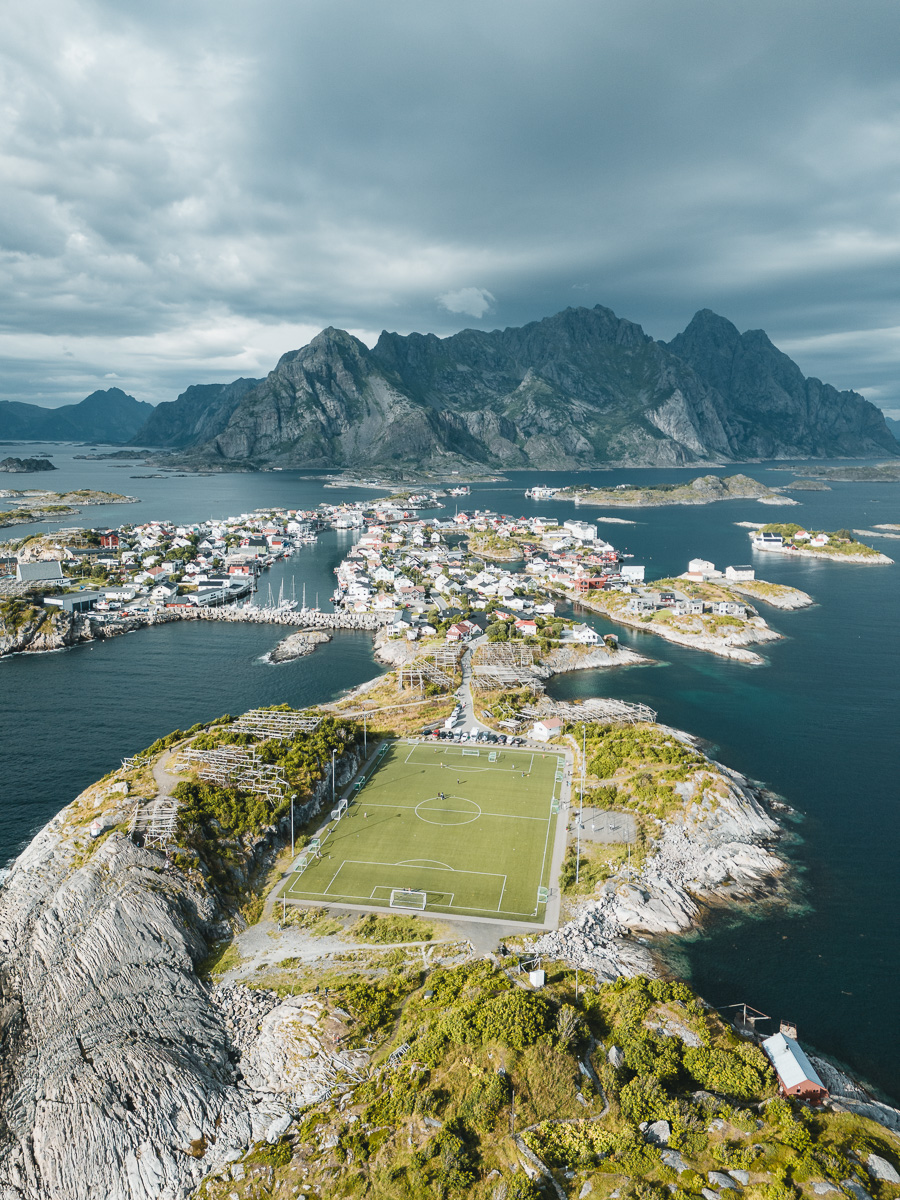
The liveliest village on the islands: a working harbour spread across small islets, with cafés, galleries and the famous football pitch perched on the rocks. The best base if you want a bit more life in the evenings, and an easy place to spend a slow day.
Three broad options: a converted rorbu cabin (atmospheric, pricey, books out early), a hotel or guesthouse in Svolvær or Leknes (practical), or camping / campervan (flexible and far cheaper – sites like Lofoten Beach Camp put you right on the sand, plus Norway's right-to-roam for responsible wild camping). In peak summer, book anything indoors months ahead.
A loose, weather-flexible plan if it's your first time. Shuffle days around the forecast – save the big hikes for the clear ones.
Fly into Leknes or take the ferry into Moskenes. Drive west to your base around Reine or Hamnøy. Easy first evening: the Hamnøy viewpoint, dinner, and a slow lap of the village to get your bearings.
Climb Reinebringen early or late to dodge the crowds and the busy lot. Lunch at Anita's Seafood. Afternoon exploring the western tip and the cabins. If the sky's clear, go back up for the midnight sun.
The signature hike: up Ryten for the view over Kvalvika, then down to the beach if you've got the legs. A full, rewarding day. Keep it as your weather-buffer day – it's worth waiting for a clear one.
Slow morning at Haukland and Uttakleiv, then drive east, stopping at Offersøykammen for a quick climb. Settle into a base around Henningsvær or Svolvær for the last nights.
A relaxed day in Henningsvær – cafés, galleries, the harbour, and Festvågtind if you want one last climb. Depart from Svolvær or Evenes, or drive back the way you came soaking up the views.
My film from a 2024 trip through the islands – the drive, the light, the hikes. Worth two minutes before you plan yours.
Lofoten's famous viewpoints are famous for a reason, but the islands still hide quieter corners. I don't share these often – so treat them gently. Tap the coordinates to open them in Maps, and leave them exactly as you found them.
White sand, turquoise water, and almost never anyone on it. No car park, no café, no marker – reached on foot from a spot most people drive straight past. Bring everything you need and leave nothing behind.
68°9'50" N · 13°22'3" EA sheltered stretch of coast I only really understood from the air. Calm, empty, and the kind of place you sit for an hour longer than planned. Look for the gaps between the well-known beaches.
68°6'48" N · 13°8'8" EIf you want your shots to look the way these do, my Nordic Lightroom pack is the starting point I use on this kind of cold, high-contrast Arctic light. Six presets, real RAW files behind every preview, 30-day refund. Optional – the guide stands on its own.
More of Norway, same treatment as this one. More on the way.